 vesseltracker.com
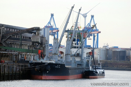
Vessel PUK DAE BONG IMO: 9020003, MMSI: 445333000 General Cargo Ship
UTC, 37.71988, 123.15709, course: -1, speed: 8.1
UTC, 37.33290, 122.97765, course: -1, speed: 9
2026-02-04 19:43:01 UTC, 37.13156, 122.97613, course: -1, speed: 8.5
Live AIS position:
UTC. 24 nm SE of Longyan Pt),
updated 2026-02-04 19:43:01 UTC.
Find the position of the vessel PUK DAE BONG on the map. The latter are known coordinates and path.
marine traffic ship tracker show on live map
The current position of vessel PUK DAE BONG is 37.13156 lat / 122.97613 lng. Updated: 2026-02-04 19:43:01 UTCCurrently sailing under the flag of Korea Democratic Republic
PUK DAE BONG built in 1991 year
Deadweight:
10030 tDetails:
Last coordinates of the vessel:
UTC, 37.88318, 123.37224, course: -1, speed: 7.4UTC, 37.71988, 123.15709, course: -1, speed: 8.1
UTC, 37.33290, 122.97765, course: -1, speed: 9
2026-02-04 19:43:01 UTC, 37.13156, 122.97613, course: -1, speed: 8.5